Determining the distance between two locations or addresses is a common question we encounter in daily life. This free web mapping tool will address this question and provide you a detailed answer. You can enter two addresses, postal codes, or coordinates in the ‘To’ and ‘From’ textboxes and this distance measuring map application will give you precise results.
Measure Distance on Map Between 2 Points & Download Data
Full Screen
Address / Postal Code / Geographic Coordinates Search
This free online distance measurement application allows you to search straight distance and driving distance between two locations. It allows you to enter complete address ( It must be accurate) or Postal code or geographic coordinates in Lat long decimal degree format.
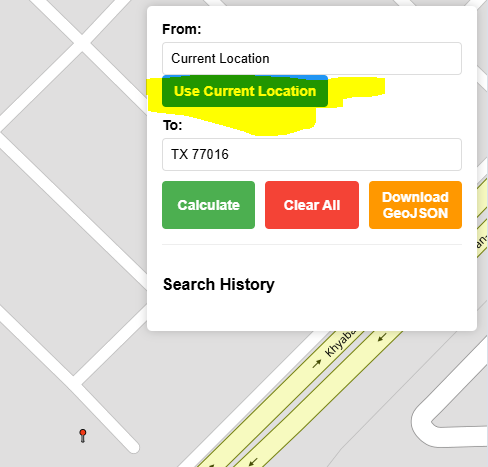
Current Location
Using this online mapping application, you can locate yourself on map to start measuring to your destination. You will need to allow your browser to read your geographic location.
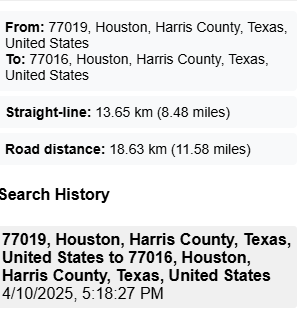
Calculation of Distance in Kilometers and Miles
Mapping distance application will draw straight line between two given points as well as it will draw shortest road route between these 2 given points. Measurement of these 2 lines will be given in km & Miles.
Download the Calculated Route Data
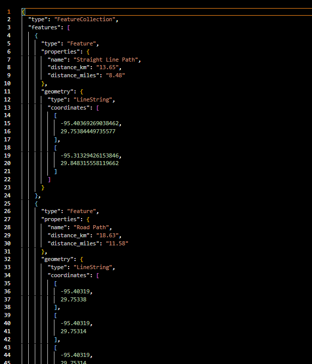
After calculating the distance between two given geographic locations, this free mapping tool will provide the option to download the geographic route data in geoJSON format ( A well known GIS data format accepted worldwide).
Real-World Usage by Profession
Distance finder can be used in many ways by different users. Few of scenarios are listed below.
- Measuring daily commute and aerial distance between home and office: General Commuters
- Estimating delivery distance between warehouse and customer to estimate delivery time: Logistics Managers
- Determining emergency response distance from fire station to location to calculate response time in case of emergency : Emergency Planners
- Calculating road trip distance between two cities to plan effective and efficient trip: Travel Planners
- Comparing driving vs. aerial distances to optimize routes: Fleet Managers
- Finding distance to the nearest hospital or clinic from desired location: Healthcare Planners
- Planning school bus routes to save time especially in the morning: School Administrators
- Analyzing store proximity to customers to assess potential customer volume: Retail Analysts
- Estimating service coverage area from a service center to estimate traveling cost: Field Service Managers
- Identifying distance between tourist spots for tour planning: Tour Guides
- Measuring distance between two project sites: Construction Managers
- Calculating the distance to renewable energy resources and national grids: Electrical Engineers
- Verifying delivery claims using route measurement for quality control : e-Commerce Auditors
- Mapping distances for campaign planning to visit potential voters: Political Strategists
- Determining location gaps in emergency response services: Urban Planners
- Calculating radius for market targeting: Marketing Analysts
- Assessing evacuation routes for disaster scenarios for swift response: Disaster Management Officers
- Verifying real estate proximity to public services like schools and hospitals: Real Estate Agents
- Planning drone delivery routes: Drone Operators
- Estimating hiking trail distances: Outdoor Enthusiasts / Park Rangers
Example : Calculating Distance to Nearby Amenities by Real Estate Agent
If your are a real estate agent and trying to help a client evaluate a potential property. The client wants to know the distance of home from nearby schools, hospitals, and shopping centers etc. You can easily show your clients each facility distance from your suggested property using this application. Simply enter the address in search bar, select nearby facility and calculate the distance in both driving directions and straight line. You can also export the route to geoJSON that can be further used in your analysis.
User Guide: How to use this free maps distance calculator to measure the distance between 2 points on map?
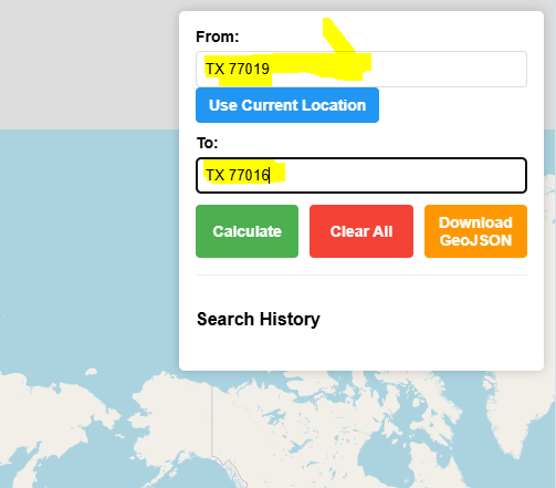
Enter Address From / To:
Use Current Location:
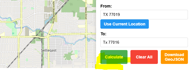
Calculate Map Distance:

Clear All:

Download GeoJSON:

Embed This Free App
<div class="iframe-container">
    <iframe src="https://onlinemapmaker.com/Free-Mapping-Tools/distance-between-two-points-map/" allowfullscreen></iframe>
</div>

<style>
    /* Responsive container that adapts to viewport height */
    .iframe-container {
        position: relative;
        width: 100%;
        height: 70vh; /* Uses 70% of viewport height */
        min-height: 500px; /* Minimum height for desktop */
        max-height: 800px; /* Maximum height limit */
        margin: 20px 0;
        background-color: #f4f4f4;
        overflow: hidden; /* Prevents scrollbars */
    }

    /* Full-size iframe */
    .iframe-container iframe {
        position: absolute;
        top: 0;
        left: 0;
        width: 100%;
        height: 100%;
        border: 0;
    }

    /* Mobile-specific adjustments */
    @media (max-width: 768px) {
        .iframe-container {
            height: 80vh; /* Uses more screen on mobile */
            min-height: 600px; /* Lower minimum for small devices */
        }
    }
</style>
Open Source Resources