We deal with geographic coordinates on daily basis. These coordinates are usually in decimal degrees to store Latitude and Longitude. Geographic data is essential for many professional fields, education and research. Geographic information can be store in different formats, if it is point data then csv file format is the easiest way to store the geodata including geographic coordinates in the form of lat, lon, and relevant information for each point. Preparing lat long map is very easy with this free online map tool; you can plot your coordinates in a matter of seconds using few clicks. This online map application provides you with an interactive map made with your own geographic data in CSV file format.
Full Screen
Lat Lon to Map Online Mapping Application
Convert your geographic coordinates into map. You can easily visualize your geographic data in point form saved as csv on street map and satellite imagery with our free Geodata online visualizer. Just create a csv file from your gps data and upload to this lat lon visualizer application. Your geodata will be displayed on map in matter of seconds.
Lat Lon to Map Tool Key Features:
- Browse CSV with coordinates Data along with other attribute data to load the geo-coordinates on map application
- Drag and Drop the same csv file to repeat above process
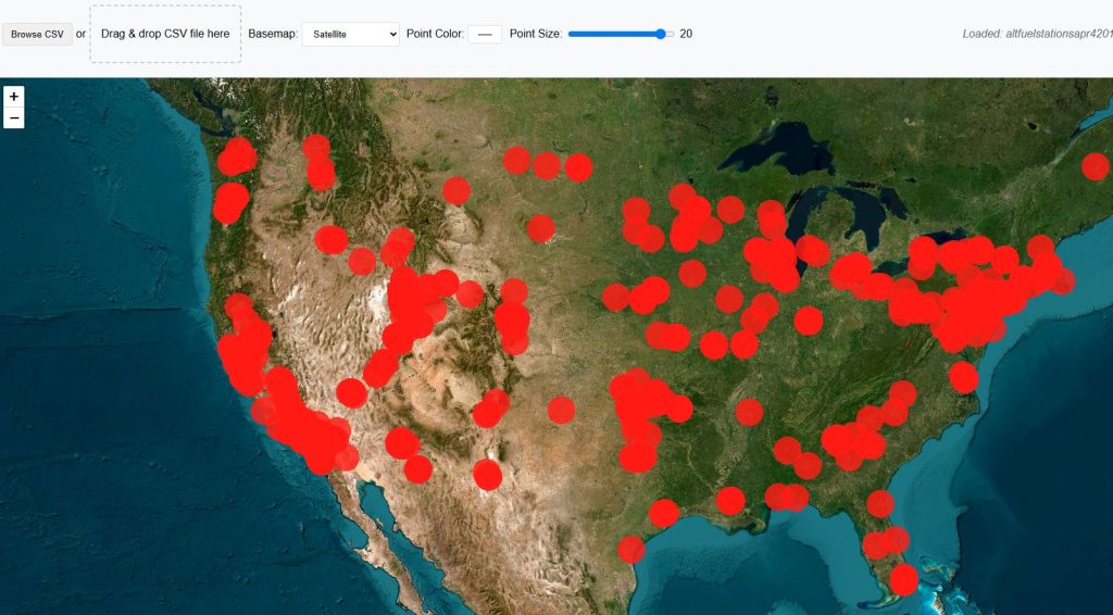
- Change Basemap to Open Street Map(OSM) or Satellite Imagery
- Change points color of your choice.
- Change size of points plotted from lat long.
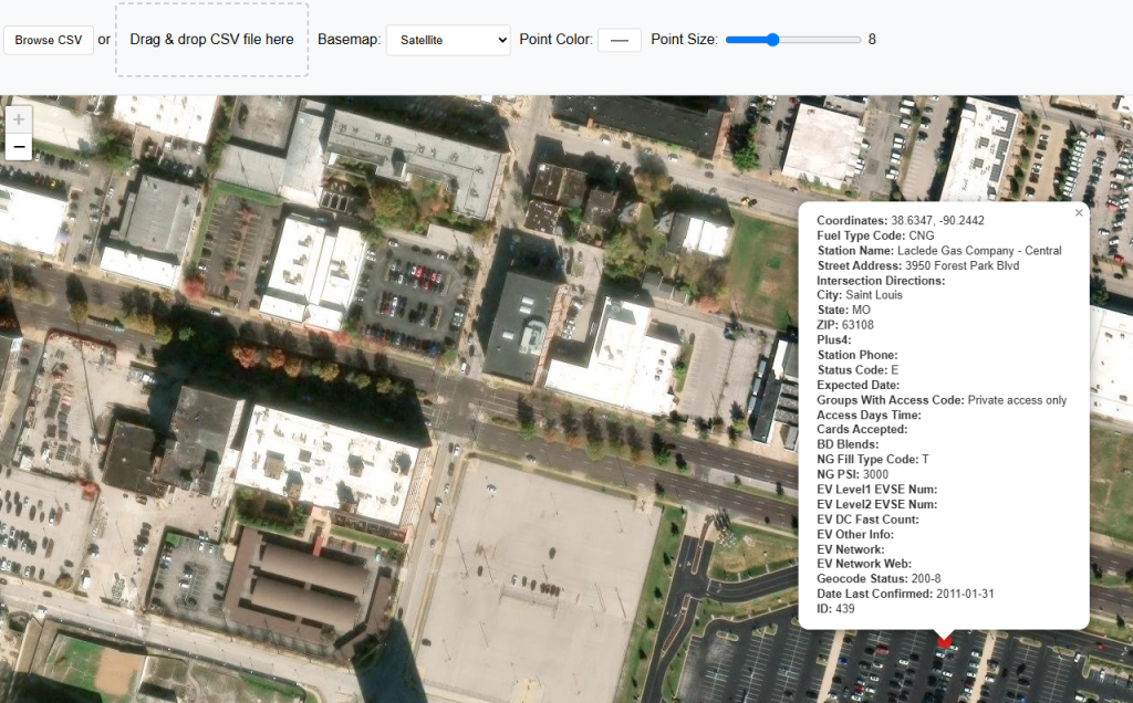
- Popup information for each point plotted
Limitations:
As this is a free tool to view your lat long data, there is a limit to view latitude longitude data on map. You can view 500 points on map at a time.
Lat Lon to Map Plotter Step By Step Guide:
Following guide will teach you about the usage of lat long data plotter on map.
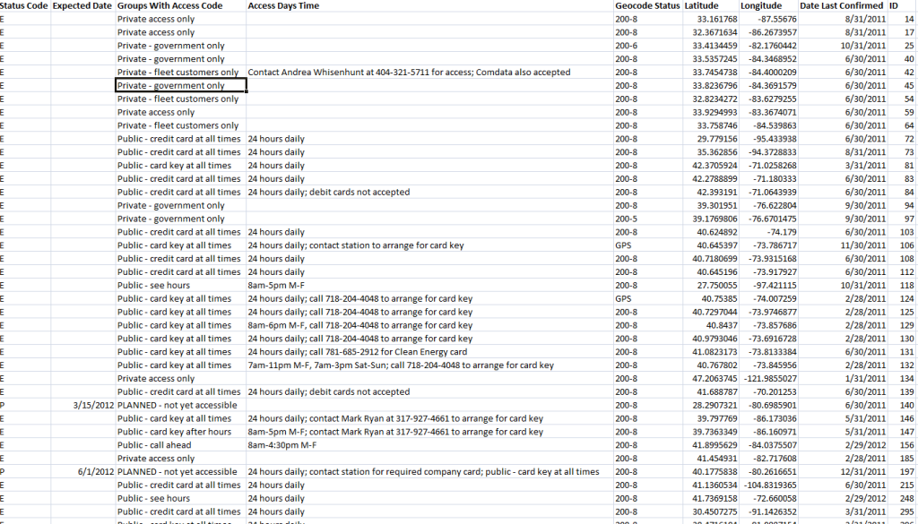
Step 1: Prepare GPS coordinates CSV file
CSV data that contains the geographic point data must have longitude and latitude separate columns. All other attributes should have respective column names. Bellow is sample csv data.
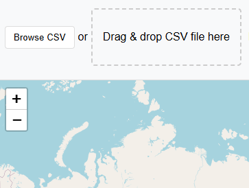
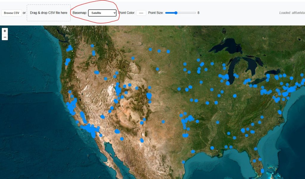
Step 2: Upload or Drag & Drop CSV file
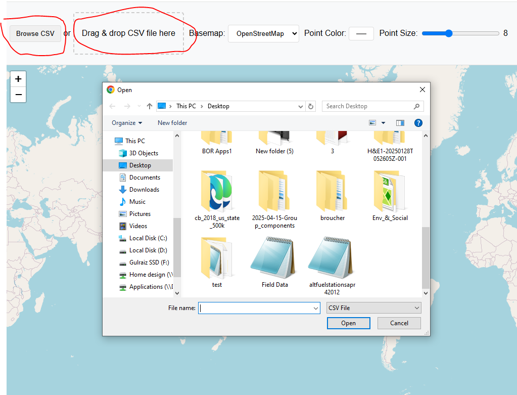
After preparing the csv data with lat lon information stored for each respective point, press “Browse CSV” button or drag & Drop your file in designated area.
Application will automatically detect the data if it is in right format and will upload immediately without pressing any button. Your map will be zoomed to the extent of csv coordinates data.
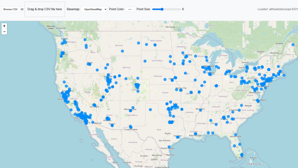
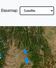
Step 3: Change Basemap if Required
Default basemap is street view by Open Street Maps OSM. Basemap can be switched to satellite imagery.
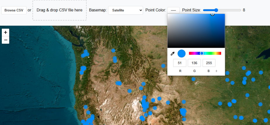
Step 4: Change Points Color
To make map more attractive color of points can be changed from color pallet.
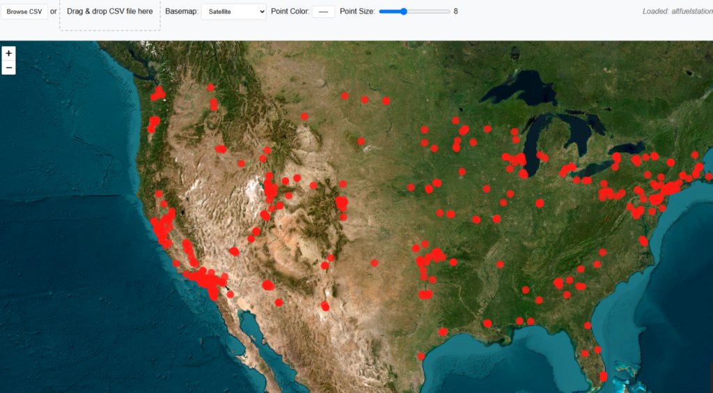
Step 5: Change Point Size
Point size can also be changed using slider from 3 to 20.
Step 6: Get Popup Information on Point Click
Click on any point on map and a popup window will be appeared, showing stored information of that point along with latitude longitude values.
Open Source Resources