This free online mapping application provides elevation on map click. Simply click on the map and get the altitude of that point from mean sea level. Click or tap the map or enter the address, postal code, zip code or geographic coordinates in Latitude & Longitude in the text box. It is a very common question in our daily lives that what’s my current elevation? This webgis mapping tool will address this question. Click or tap on “My Location” then the map will zoom to My Current Location and will add a marker on map. Now tap or click on map to get the elevation.
What’s My Current Elevation? Below is the answer:
Full Screen
Finding your current elevation is very easy by using this elevation finder application which uses openstreet map. You can switch maps between satellite imagery and topographic maps as well. This application will help you to find your current elevation from mean sea level with accuracy within 90×90 meters as it is using elevation dataset of 90m resolution. This elevation finder tool use open-source technologies that are free to use. You can use this application absolutely free.
It provides the following functionalities to calculate the elation on map.
- Search Address on Map
- Search Postal Code or Zip Code on Map
- Search by Geographic Coordinates
- Use My Current Location
- Basemap Switcher
- Latitude / Longitude at Bottom for Mouse Current Location
- Elevation Finder Using Click on Map
- Elevation in Meters and Feet
Who Can Benefit from this Application
- Civil Engineers: This tool can be used to assess terrain elevation before planning different projects like roadways, bridges, or drainage systems.
- Surveyors: Quickly check elevation value on-site for mapping, land division, and construction planning.
- Urban Planners: Evaluate altitude differences between different city zones for various planning tasks zoning, infrastructure development, and flood management.
- Environmental Scientists: Sometimes instant elevation value is required to study and plan ecosystems, water flow, and climate modeling.
- Real Estate Developers: Find site elevation for drainage design, accessibility to property, and estimate potential value while selecting land for housing or commercial development.
- Hikers & Outdoor Enthusiasts: Get to know specific location’s altitude before or during hiking, climbing, or trekking activities.
- Telecommunications Engineers: Planning towers before installation and know the coverage.
- Disaster Management Professionals: efficient disaster management like to find potential flood areas by using the altitude values.
- Photographers & Videographers (Drone Operators): Plan shoots based on elevation for capturing aerial photos or videos, especially in landscapes and cityscapes.
- Agricultural Planners: Assess field elevation to design efficient irrigation systems and manage water flow.
Example: Use of Elevation Finder for Flood Risk Assessment.
Imagine you are a disaster management expert in New Orleans, Louisiana. You need to know flood risks in low-lying neighborhoods while making a disaster management plan. By identifying areas with low elevation as compared to sea level , you can make effective evacuation routes and strategically place emergency shelters on higher grounds with maximum effectiveness.
Elevation Map Application User Guide:
We will go through it step by step to use this elevation map application to answer your question: what’s my current elevation on the map using my current geographic location
Step 1: Locate Yourself on Map Using Elevation Finder Application:
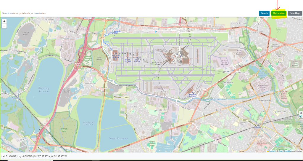
There are two options to locate yourself on map to get the elevation of your desired location. Let’s talk about “My Current Location” first. At top of the application in menu bar there is a green button with “My Location” text. Press it and browser will ask to allow to read your current location. Allow the browser then the map will be zoomed to your current location.
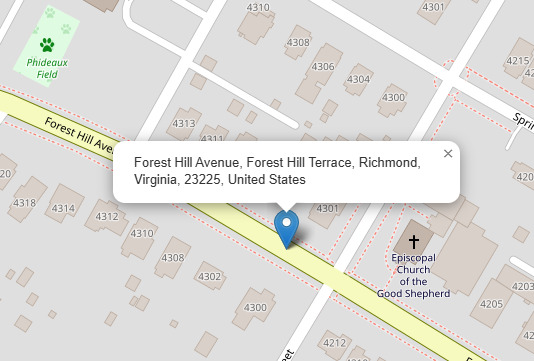
The location can also be searched in the form of postal address, zip code / Postal code, geographic coordinates latitude & Longitude. You can use the search bar on top of the application to enter the required information.

Step 2: Find Elevation on Map
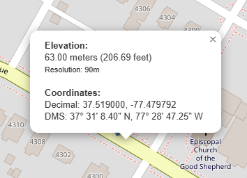
Now we are on the location where we can find the altitude on map. Place mouse pointer on map where elevation information is required and click on map. A popup with relevant information will be appeared as shown in the screenshot below.
Base Map Switcher
An additional functionality for users to enhance user experience, we introduce basemap switcher. With the help of basemap switcher user can easily change view from streetmap to satellite or topographic map.
Open Source Resources