Do you want to know the area of your plot of land, your agricultural land area or the area of your rooftop in square feet, square meters, square yards, square kilometers, square miles or acres? Simply draw the area on our Free Land Area Calculator Map tool. It will provide the measured area in multiple units. Our free Land Area Calculator Map tool makes it easy to use.
Square Footage Calculator on Map
Full Screen
Area calculator – Find the area of a shape you draw on free opensource webmap with Openstreet Maps.
This free webgis tools allows you to calculate area of your desired location on web map using up to date OSM data in variety of units.
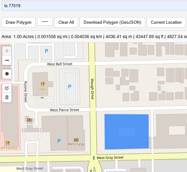
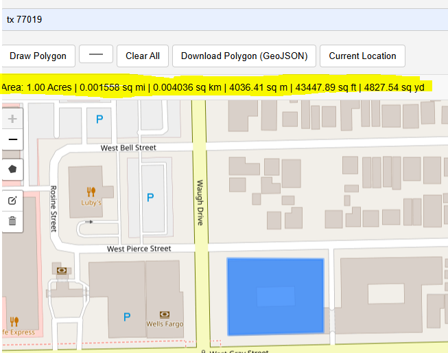
Square Feet:
This tool allows users to draw a shape and instantly see its area in square feet.
Square Meter:
By default it calculates area of the drawn polygon in square meters. Convenient drawing tool will make it easy to calculate area in square meters on web map.
Square Yards:
As the area has been calculated in square meters, Using unit conversion, you can easily calculate square yards by using following conversion formula. Square yards = Square meters × 1.19599
Users Who Can Benefit from This Tool
- Real Estate: Calculate the area of a residential or commercial plots.
- Farmers: Estimating agricultural farmland size to estimate yield.
- Renewable Energy Experts: Measuring rooftop area for solar panel installation for technical and financial feasibilities.
- Landscape Planners: Planning landscaping or garden space to assess required resources.
- Building Planners: Assessing the area of a parking lot to know parking capacity.
- School Administration: Calculating school or campus grounds.
- Civil Engineers: Estimating construction site boundaries to allocate appropriate resources.
- Forestry Experts & Environmental Scientists : Measuring forest or greenbelt areas for further analysis.
- Recreational Facility Planners: Mapping sports fields or stadiums.
- Property Developer: Defining land for lease or sale in real estate.
- Irrigation Experts: Calculating area for irrigation planning of major and minor channels.
- Contractors: Planning fencing requirements around a property.
- Remote Sensing Experts: Determining area coverage for drone surveillance.
- Event Planners: Estimating land for festival or event setup.
- Cemetery Managers: Measuring cemetery plot areas.
- Parks Administrators: Calculating campground or park size.
- Municipality: Measuring public utility land (e.g., water treatment plant).
- Community Planners: Planning allotments for community gardens.
- Logistics Experts: Defining warehouse or industrial zone boundaries to achieve optimum results.
- Disaster Management Specialists: Estimating surface area for flood risk analysis and other natural disasters.
Example 1: Rooftop Area Calculation for Solar Panels Installation
Let’s suppose you are a home owner living in San Diego, California. You are interested in clean energy for your home. You want to install solar panels on your rooftop to reduce the electricity bill and to have environment friendly electricity resource. Before contacting the contractor you can estimate the available area on your rooftop by using this tool and can estimate the solar energy potential on your rooftop.
Example 2: Estimating Farm Size for Crop Planning
Imagine you have an agricultural land in lowa near Ames. You are preparing for upcoming season. This app will help you to estimate the size of each section of your farmland to plan how much seed and fertilizer is required. Instead of using traditional manual measurement techniques or complex GIS software that are designed for GIS experts, you ca use this Land Area Calculator. Detailed user guide is bellow.
User Guide: How to use this free web mapping tool to calculate area on map?
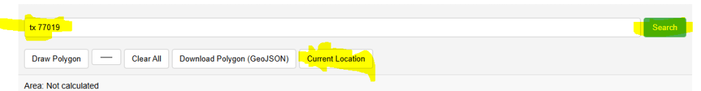
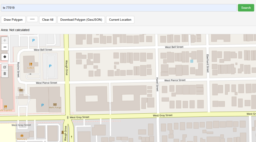
Locate the Address/ Zip Code / Current User Location:
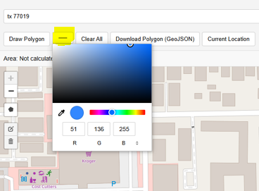
Choose Shape Color:
Draw Polygon
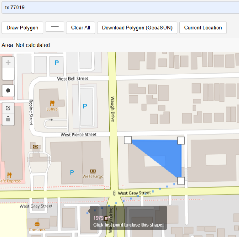
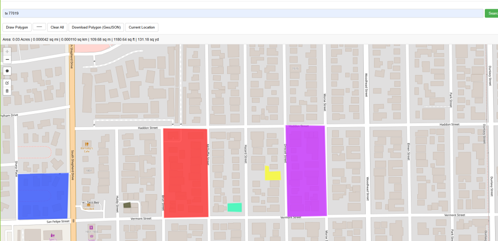
Multiple polygons can be added to the map in different colors of your choice. Summary section of area will show cumulative area for all polygons.
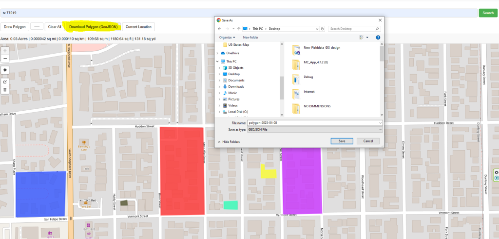
All polygons can be downloaded in GeoJSON format and used in popular GIS software like Esri ArcMap, ArcGIS Pro, QGIS, Google Earth etc.
Open Source Resources